Gemeindegrenzen

File Geodatabase Feature Class
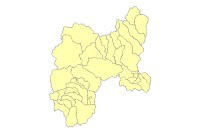
Thumbnail

Tags
Carto Region, Administrative boundaries, Swiss National Park


Summary

Administrative boundaries in the region of the Swiss Nationalpark

Description

Administrative boundaries in theregion of the Swiss Nationalpark

Credits

Use limitations

Extent

West 9.687366   East 10.515246
North 47.017231   South 46.346294

Scale Range
Maximum (zoomed in) 1:5,000
Minimum (zoomed out) 1:150,000,000

ArcGIS Metadata 

Topics and Keywords 

Themes or categories of the resource  boundaries


*Content type  Downloadable Data


Theme keywords  Carto Region, Administrative boundaries, Swiss National Park

Citation 

*Title Gemeindegrenzen


Presentation formats* digital map


Resource Details 

Dataset languages  English (SWITZERLAND)
Dataset character set  utf8 - 8 bit UCS Transfer Format


Status  completed
Spatial representation type* vector


*Processing environment Microsoft Windows XP Version 5.1 (Build 2600) Service Pack 3; Esri ArcGIS 10.1.1.3143


ArcGIS item properties
*Name Gemeindegrenzen
*Location file://\\marmota\Data\maindata\snp\carto\gis_pub\carto_region.gdb
*Access protocol Local Area Network

Extents 

Extent
Description
ground condition
Temporal extent
Date and time 2007-01-01

Extent
Geographic extent
Bounding rectangle
Extent type  Extent used for searching
*West longitude 9.687366
*East longitude 10.515246
*North latitude 47.017231
*South latitude 46.346294
*Extent contains the resource Yes

Extent in the item's coordinate system
*West longitude 772937.099400
*East longitude 833840.697000
*South latitude 137160.300000
*North latitude 209715.050000
*Extent contains the resource Yes

Resource Points of Contact 

Point of contact
Individual's name Christian Schmid
Organization's name SNP
Contact's role  point of contact


Resource Maintenance 

Resource maintenance
Update frequency  as needed


Spatial Reference 

ArcGIS coordinate system
*Type Projected
*Geographic coordinate reference GCS_CH1903
*Projection CH1903_LV03
*Coordinate reference details
Projected coordinate system
Well-known identifier 21781
X origin -29386400
Y origin -33067900
XY scale 10000
Z origin -100000
Z scale 10000
M origin -100000
M scale 10000
XY tolerance 0.001
Z tolerance 0.001
M tolerance 0.001
High precision true
Latest well-known identifier 21781
Well-known text PROJCS["CH1903_LV03",GEOGCS["GCS_CH1903",DATUM["D_CH1903",SPHEROID["Bessel_1841",6377397.155,299.1528128]],PRIMEM["Greenwich",0.0],UNIT["Degree",0.0174532925199433]],PROJECTION["Hotine_Oblique_Mercator_Azimuth_Center"],PARAMETER["False_Easting",600000.0],PARAMETER["False_Northing",200000.0],PARAMETER["Scale_Factor",1.0],PARAMETER["Azimuth",90.0],PARAMETER["Longitude_Of_Center",7.439583333333333],PARAMETER["Latitude_Of_Center",46.95240555555556],UNIT["Meter",1.0],AUTHORITY["EPSG",21781]]

Reference system identifier
*Value 21781
*Codespace EPSG
*Version 7.11.2


Spatial Data Properties 

Vector
*Level of topology for this dataset  geometry only


Geometric objects
Feature class name Gemeindegrenzen
*Object type  composite
*Object count 31


ArcGIS Feature Class Properties
Feature class name Gemeindegrenzen
*Feature type Simple
*Geometry type Polygon
*Has topology FALSE
*Feature count 31
*Spatial index TRUE
*Linear referencing FALSE


Data Quality 

Geoprocessing history 

Process
Process name Create Feature Class
Date 2006-03-29 14:38:57
Tool location C:\Programme\ArcGIS\ArcToolbox\Toolboxes\Data Management Tools.tbx\CreateFeatureclass
Command issued
CreateFeatureclass "H:\Internet Karte\Geomedia Web Map\Geodaten" Gemeindegrenzen # region_Layer SAME_AS_TEMPLATE SAME_AS_TEMPLATE "{B286C06B-0879-11D2-AACA-00C04FA33C20};-1414234.37905635 -2010234.37905635 493.054540455605;0 100000;0 100000" # 0 0 0 "H:\Internet Karte\Geomedia Web Map\Geodaten\Gemeindegrenzen.shp"
Include in lineage when exporting metadata No


Process
Process name Append
Date 2006-03-29 14:38:59
Tool location C:\Programme\ArcGIS\ArcToolbox\Toolboxes\Data Management Tools.tbx\Append
Command issued
Append region_Layer "H:\Internet Karte\Geomedia Web Map\Geodaten\Gemeindegrenzen.shp" TEST "H:\Internet Karte\Geomedia Web Map\Geodaten\Gemeindegrenzen.shp"
Include in lineage when exporting metadata No


Process
Process name FeatureClassToFeatureClass_2
Date 2006-03-29 14:39:00
Tool location C:\Programme\ArcGIS\ArcToolbox\Toolboxes\Conversion Tools.tbx\FeatureClassToFeatureClass
Command issued
FeatureClassToFeatureClass Q:\maindata\gis_gr\adm\region.adm_gden "H:\Internet Karte\Geomedia Web Map\Geodaten" Gemeindegrenzen # "AREA AREA VISIBLE;PERIMETER PERIMETER VISIBLE;ADM_GDEN# ADM_GDEN_ VISIBLE;ADM_GDEN-ID ADM_GDEN_I VISIBLE;NAME NAME VISIBLE;NUMMER NUMMER VISIBLE" SAME_AS_TEMPLATE SAME_AS_TEMPLATE # 0 "H:\Internet Karte\Geomedia Web Map\Geodaten\Gemeindegrenzen.shp"
Include in lineage when exporting metadata No


Process
Process name
Date 2009-09-03 09:36:19
Tool location C:\Programme\ArcGIS\ArcToolbox\Toolboxes\Data Management Tools.tbx\CopyFeatures
Command issued
CopyFeatures Q:\maindata\snp\gis_carto_region\Gemeindegrenzen.shp Q:\maindata\snp\gis_infra\carto_region.gdb\Gemeindegrenzen # 0 0 0
Include in lineage when exporting metadata No


Distribution 

Distribution format
*Name File Geodatabase Feature Class


Fields 

Details for object Gemeindegrenzen 
*Type Feature Class
*Row count 31


Field OBJECTID
 
*Alias OBJECTID
*Data type OID
*Width 4
*Precision 0
*Scale 0
*Field description
Internal feature number.
*Description source
ESRI
*Description of values Sequential unique whole numbers that are automatically generated.


Field Shape
 
*Alias Shape
*Data type Geometry
*Width 0
*Precision 0
*Scale 0
*Field description
Feature geometry.
*Description source
ESRI
*Description of values Coordinates defining the features.


Field AREA
 
*Alias AREA
*Data type Double
*Width 8
*Precision 0
*Scale 0


Field PERIMETER
 
*Alias PERIMETER
*Data type Double
*Width 8
*Precision 0
*Scale 0


Field ADM_GDEN_
 
*Alias ADM_GDEN_
*Data type Integer
*Width 4
*Precision 0
*Scale 0


Field ADM_GDEN_I
 
*Alias ADM_GDEN_I
*Data type Integer
*Width 4
*Precision 0
*Scale 0


Field NAME
 
*Alias NAME
*Data type String
*Width 50
*Precision 0
*Scale 0


Field NUMMER
 
*Alias NUMMER
*Data type SmallInteger
*Width 2
*Precision 0
*Scale 0


Field Shape_Length
 
*Alias Shape_Length
*Data type Double
*Width 8
*Precision 0
*Scale 0
*Field description
Length of feature in internal units.
*Description source
ESRI
*Description of values Positive real numbers that are automatically generated.


Field Shape_Area
 
*Alias Shape_Area
*Data type Double
*Width 8
*Precision 0
*Scale 0
*Field description
Area of feature in internal units squared.
*Description source
ESRI
*Description of values Positive real numbers that are automatically generated.


Metadata Details 

Metadata language English (SWITZERLAND)
Metadata character set  utf8 - 8 bit UCS Transfer Format


Scope of the data described by the metadata  dataset
Scope name* dataset


*Last update 2013-02-26


ArcGIS metadata properties
Metadata format ArcGIS 1.0
Standard or profile used to edit metadata FGDC


Created in ArcGIS for the item 2007-02-15 10:19:38
Last modified in ArcGIS for the item 2013-02-26 17:39:43


Automatic updates
Have been performed Yes
Last update 2013-02-26 17:38:25


Metadata Contacts 

Metadata contact
Individual's name Schweizerischer Nationalpark
Contact's position Bereich Forschung und Geoinformation


Thumbnail and Enclosures 

Thumbnail
Thumbnail type  JPG

Enclosure
Enclosure type  File
Description of enclosure original metadata
Original metadata document, which was translated yes
Source metadata format fgdc

FGDC Metadata (read-only) 

Identification 

Citation
Citation Information
OriginatorREQUIRED: The name of an organization or individual that developed the data set.
Publication DateREQUIRED:  he date when the data set is published or otherwise made available for release.
Title
Gemeindegrenzen
Geospatial Data Presentation Formvector digital data
Online Linkage\\marmota\GisData\maindata\snp\gis_infra\carto_region.gdb

Description
Abstract
Administrative boundaries in theregion of the Swiss Nationalpark
Time Period of Content
Time Period Information
Single Date/Time
Calendar Date2007
Currentness Reference
ground condition
Status
ProgressComplete
Maintenance and Update FrequencyAs needed

Spatial Domain
Bounding Coordinates
West Bounding Coordinate9.687366
East Bounding Coordinate10.515246
North Bounding Coordinate47.017231
South Bounding Coordinate46.346294

Keywords
Theme
Theme KeywordCarto Region
Theme KeywordAdministrative boundaries
Theme KeywordSwiss National Park

Point of Contact
Contact Information
Contact Person Primary
Contact PersonChristian Schmid
Contact OrganizationSNP

Native Data Set Environment
Microsoft Windows XP Version 5.1 (Build 2600) Service Pack 3; ESRI ArcCatalog 9.3.1.3000

Data Quality 

Lineage
Source Information
Source Citation Abbreviation
Dataset 'adm' (Kantonale Verwaltung Graubünden)
Process Step
Process Description
Dataset copied.
Source Used Citation Abbreviation
Z:\BM2_Schweiz\Geodata\Restliche Vektordaten\Gemeindegrenzen


Process Step
Process Description
Dataset moved.
Source Used Citation Abbreviation
C:\GIS_Test\Infra_GISSNP\Gemeindegrenzen


Process Step
Process Description
Dataset copied.
Source Used Citation Abbreviation
Q:\prjdata\infra\GISSNP_Infrastruktur\Grenzen\Gemeindegrenzen


Spatial Reference 

Horizontal Coordinate System Definition
Planar
Planar Coordinate Information
Planar Coordinate Encoding Methodcoordinate pair
Coordinate Representation
Abscissa Resolution0.000100
Ordinate Resolution0.000100
Planar Distance Unitsmeters

Geodetic Model
Horizontal Datum NameD_CH1903
Ellipsoid NameBessel 1841
Semi-major Axis6377397.155000
Denominator of Flattening Ratio299.152813

Entities and Attributes 

Distribution Information 

Resource DescriptionDownloadable Data
Standard Order Process
Digital Form
Digital Transfer Information
Transfer Size0.512

Metadata Reference 

Metadata Date2009-09-03
Metadata Contact
Contact Information
Contact Organization Primary
Contact OrganizationREQUIRED: The organization responsible for the metadata information.
Contact PersonREQUIRED: The person responsible for the metadata information.
Contact Address
Address TypeREQUIRED: The mailing and/or physical address for the organization or individual.
CityREQUIRED: The city of the address.
State or ProvinceREQUIRED: The state or province of the address.
Postal CodeREQUIRED: The ZIP or other postal code of the address.

Contact Voice TelephoneREQUIRED: The telephone number by which individuals can speak to the organization or individual.

Metadata Standard NameFGDC Content Standards for Digital Geospatial Metadata
Metadata Standard VersionFGDC-STD-001-1998
Metadata Time Conventionlocal time