perimeter_arc

File Geodatabase Feature Class
Thumbnail

Tags
perimeter burnt area il Fuorn, Ofenpass, il Fuorn, Swiss National Park


Summary

IT can be used for cartograühical representations but also spatial analysis within forest fire research (especially fire effects, post fire regeneration, fire ecology), but also other applications (e.g. wildlife habitat analysis).

Description

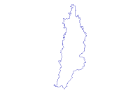
Perimeter corresponds to the outer polygon of the data set 'veg_br_fuorn' (vegetation units).

Credits

GIS-SNP, Swiss National Park

Use limitations

Data use within research and management projects that are linked to the Swiss National Park

Extent

West 10.214343   East 10.217855
North 46.671436   South 46.665670

Scale Range

ArcGIS Metadata 

Topics and Keywords 

*Content type  Downloadable Data


Place keywords  Ofenpass, il Fuorn, Swiss National Park

Thesaurus
Title Hotel il Fuorn


Theme keywords  perimeter burnt area il Fuorn

Thesaurus
Title study site


Citation 

*Title perimeter_arc


Presentation formats* digital map


Resource Details 

Dataset languages  de/en (SWITZERLAND)


Status  completed
Spatial representation type* vector


Supplemental information
The data were derived from aerial IR photographs 1:3000 (WILD camera 17018, focal length 303.63 mm, approximate flying altitude 3100 m.a.s.l.), taken on September 3, 1984. Photogrammetry was performed on March 3, 1987 by Patrick Thee on Modell NP842425, WSL, Birmensdorf, formerly EAFV).
*Processing environment Microsoft Windows 7 Version 6.1 (Build 7601) Service Pack 1; Esri ArcGIS 10.1.1.3143


Credits
GIS-SNP, Swiss National Park
ArcGIS item properties
*Name perimeter_arc
*Location file://\\marmota\Data\maindata\snp\ilfuorn\gis_pub\brandflaeche.gdb
*Access protocol Local Area Network

Extents 

Extent
Description
ground condition
Extent
Geographic extent
Bounding rectangle
Extent type  Extent used for searching
*West longitude 10.214343
*East longitude 10.217855
*North latitude 46.671436
*South latitude 46.665670
*Extent contains the resource Yes

Extent in the item's coordinate system
*West longitude 812282.000000
*East longitude 812528.500000
*South latitude 171893.125000
*North latitude 172525.703125
*Extent contains the resource Yes

Resource Points of Contact 

Point of contact
Individual's name Ruedi Haller
Organization's name Swiss National Park
Contact's position Bereich Rauminformation Schweizerischer Nationalpark
Contact's role  point of contact


Contact information
Phone
Voice +41 (0)81 851 4111

Address
Type both
Delivery point Schweizerischer Nationalpark
City Zernez
Administrative area Graubünden
Postal code CH-7530
Country CH
e-mail addressgis@nationalpark.ch


Resource Maintenance 

Resource maintenance
Update frequency  not planned


Resource Constraints 

Legal constraints
Other constraints
Data access via GIS-SNP / Ruedi Haller, Schweizerischer Nationalpark, Zernez, Switzerland
Security constraints
Classification  unclassified


Constraints
Limitations of use
Data use within research and management projects that are linked to the Swiss National Park

Spatial Reference 

ArcGIS coordinate system
*Type Projected
*Geographic coordinate reference GCS_CH1903
*Projection CH1903_LV03
*Coordinate reference details
Projected coordinate system
Well-known identifier 21781
X origin 812275.83750000002
Y origin 171877.310546875
XY scale 13560830932171.783
Z origin -100000
Z scale 10000
M origin -100000
M scale 10000
XY tolerance 0.063257812499999996
Z tolerance 0.001
M tolerance 0.001
High precision true
Latest well-known identifier 21781
Well-known text PROJCS["CH1903_LV03",GEOGCS["GCS_CH1903",DATUM["D_CH1903",SPHEROID["Bessel_1841",6377397.155,299.1528128]],PRIMEM["Greenwich",0.0],UNIT["Degree",0.0174532925199433]],PROJECTION["Hotine_Oblique_Mercator_Azimuth_Center"],PARAMETER["False_Easting",600000.0],PARAMETER["False_Northing",200000.0],PARAMETER["Scale_Factor",1.0],PARAMETER["Azimuth",90.0],PARAMETER["Longitude_Of_Center",7.439583333333333],PARAMETER["Latitude_Of_Center",46.95240555555556],UNIT["Meter",1.0],AUTHORITY["EPSG",21781]]

Reference system identifier
*Value 21781
*Codespace EPSG
*Version 7.11.2


Spatial Data Properties 

Indirect spatial referencing
Burnt area east of Hotel Il Fuorn, Ofenpass, Swiss National Park

Vector
*Level of topology for this dataset  geometry only


Geometric objects
Feature class name perimeter_arc
*Object type  composite
*Object count 48


ArcGIS Feature Class Properties
Feature class name perimeter_arc
*Feature type Simple
*Geometry type Polyline
*Has topology FALSE
*Feature count 48
*Spatial index TRUE
*Linear referencing FALSE


Data Quality 

Geoprocessing history 

Process
Date 2009-09-23 17:06:00
Tool location C:\Programme\ArcGIS\ArcToolbox\Toolboxes\Data Management Tools.tbx\CopyFeatures
Command issued
CopyFeatures Q:\maindata\snp\ilfuorn\gis_pub\perimeter\arc Q:\maindata\snp\ilfuorn\gis_pub\brandflaeche.gdb\perimeter_arc # 0 0 0
Include in lineage when exporting metadata No


Distribution 

Distributor
Ordering process
Instructions
Ruedi Haller, Bereich Rauminformation, Schweizerischer Nationalpark, CH-7530 Zernez, gis@nationalpark.ch

Transfer options
Online source
Description  Data accessable via GIS-SNP, Swiss National Park, CH-7530 Zernez


Distribution format
*Name File Geodatabase Feature Class


Fields 

Details for object perimeter_arc 
*Type Feature Class
*Row count 48


Field OBJECTID
 
*Alias OBJECTID
*Data type OID
*Width 4
*Precision 0
*Scale 0
*Field description
Internal feature number.
*Description source
ESRI
*Description of values Sequential unique whole numbers that are automatically generated.


Field Shape
 
*Alias Shape
*Data type Geometry
*Width 0
*Precision 0
*Scale 0
*Field description
Feature geometry.
*Description source
ESRI
*Description of values Coordinates defining the features.


Field FNODE_
 
*Alias FNODE_
*Data type Integer
*Width 4
*Precision 0
*Scale 0


Field TNODE_
 
*Alias TNODE_
*Data type Integer
*Width 4
*Precision 0
*Scale 0


Field LPOLY_
 
*Alias LPOLY_
*Data type Integer
*Width 4
*Precision 0
*Scale 0


Field RPOLY_
 
*Alias RPOLY_
*Data type Integer
*Width 4
*Precision 0
*Scale 0


Field LENGTH
 
*Width 4
*Output width 12
*Data type Single
*Alias LENGTH
*Precision 0
*Scale 0
*Field description
Length of feature in internal units.
*Description source
ESRI
*Description of values Positive real numbers that are automatically generated.


Field PERIMETER_
 
*Alias PERIMETER_
*Data type Integer
*Width 4
*Precision 0
*Scale 0


Field PERIMETER_ID
 
*Alias PERIMETER_ID
*Data type Integer
*Width 4
*Precision 0
*Scale 0


Field Shape_Length
 
*Alias Shape_Length
*Data type Double
*Width 8
*Precision 0
*Scale 0
*Field description
Length of feature in internal units.
*Description source
ESRI
*Description of values Positive real numbers that are automatically generated.


References 

Aggregate Information
Association type  cross reference


Aggregate resource name
Title living_trees


Presentation formats  digital map
FGDC geospatial presentation format  vector digital data


Metadata Details 

Metadata language English (SWITZERLAND)
Metadata character set  utf8 - 8 bit UCS Transfer Format


Scope of the data described by the metadata  dataset
Scope name* dataset


*Last update 2013-03-06


ArcGIS metadata properties
Metadata format ArcGIS 1.0


Created in ArcGIS for the item 2007-07-17 23:21:22
Last modified in ArcGIS for the item 2013-03-06 14:52:07


Automatic updates
Have been performed Yes
Last update 2013-03-06 14:52:07


Metadata Contacts 

Metadata contact
Individual's name Britta Allgöwer / GIS-SNP Zürich / GIUZ
Organization's name GIS Schweizerischer Nationalpark, CH-7530 Zernez, Switzerland
Contact's role  point of contact


Contact information
Phone
Voice +41 81 856 12 82

Address
Type both
Delivery point Schweizerischer Nationalpark
City Zernez.
Administrative area Graubünden
Postal code CH-7530 Zernez
Country CH
e-mail addressgis@nationalpark.ch


Thumbnail and Enclosures 

Thumbnail
Thumbnail type  BMP

Enclosure
Enclosure type  File
Description of enclosure original metadata
Original metadata document, which was translated yes
Source metadata format fgdc

FGDC Metadata (read-only) 

Identification 

Citation
Citation Information
OriginatorREQUIRED: The name of an organization or individual that developed the data set.
Publication DateREQUIRED:  he date when the data set is published or otherwise made available for release.
Title
perimeter_arc
Geospatial Data Presentation Formvector digital data
Online Linkage\\marmota\GisData\maindata\snp\ilfuorn\gis_pub\brandflaeche.gdb

Description
Abstract
Perimeter corresponds to the outer polygon of the data set 'veg_br_fuorn' (vegetation units).
Purpose
IT can be used for cartograühical representations but also spatial analysis within forest fire research (especially fire effects, post fire regeneration, fire ecology), but also other applications (e.g. wildlife habitat analysis).
Supplemental Information
The data were derived from aerial IR photographs 1:3000 (WILD camera 17018, focal length 303.63 mm, approximate flying altitude 3100 m.a.s.l.), taken on September 3, 1984. Photogrammetry was performed on March 3, 1987 by Patrick Thee on Modell NP842425, WSL, Birmensdorf,  formerly EAFV).
Time Period of Content
Time Period Information
Single Date/Time
Calendar Date3.9.1984
Currentness Reference
ground condition
Status
ProgressComplete
Maintenance and Update FrequencyNone planned

Spatial Domain
Bounding Coordinates
West Bounding CoordinateREQUIRED: Western-most coordinate of the limit of coverage expressed in longitude.
East Bounding CoordinateREQUIRED: Eastern-most coordinate of the limit of coverage expressed in longitude.
North Bounding CoordinateREQUIRED: Northern-most coordinate of the limit of coverage expressed in latitude.
South Bounding CoordinateREQUIRED: Southern-most coordinate of the limit of coverage expressed in latitude.

Keywords
Theme
Theme Keyword Thesaurusstudy site
Theme Keywordperimeter burnt area il Fuorn

Place
Place Keyword ThesaurusHotel il Fuorn
Place KeywordOfenpass, il Fuorn, Swiss National Park

Access Constraints
Data access via GIS-SNP / Ruedi Haller, Schweizerischer Nationalpark, Zernez, Switzerland
Use Constraints
Data use within research and management projects that are linked to the Swiss National Park
Point of Contact
Contact Information
Contact Organization Primary
Contact OrganizationSwiss National Park
Contact PersonRuedi Haller
Contact PositionBereich Rauminformation Schweizerischer Nationalpark
Contact Address
Address Typemailing and physical address
AddressSchweizerischer Nationalpark
CityZernez
State or ProvinceGraubünden
Postal CodeCH-7530
CountrySwitzerland

Contact Voice Telephone+41 (0)81 851 4111
Contact Electronic Mail Addressgis@nationalpark.ch

Data Set Credit
GIS-SNP, Swiss National Park
Security Information
Security ClassificationUnclassified

Native Data Set Environment
Microsoft Windows XP Version 5.1 (Build 2600) Service Pack 3; ESRI ArcCatalog 9.3.1.3000
Cross Reference
Citation Information
Title
living_trees
Geospatial Data Presentation Formvector digital data


Data Quality 

Completeness Report
complete

Spatial Reference 

Horizontal Coordinate System Definition

Entities and Attributes 

Distribution Information 

Resource DescriptionData accessable via GIS-SNP, Swiss National Park, CH-7530 Zernez
Standard Order Process
Digital Form
Digital Transfer Information
Transfer Size0.130

Custom Order Process
Ruedi Haller, Bereich Rauminformation, Schweizerischer Nationalpark, CH-7530 Zernez, gis@nationalpark.ch


Metadata Reference 

Metadata Date2009-09-23
Metadata Contact
Contact Information
Contact Organization Primary
Contact OrganizationGIS Schweizerischer Nationalpark, CH-7530 Zernez, Switzerland
Contact PersonBritta Allgöwer / GIS-SNP Zürich / GIUZ
Contact Address
Address Typemailing and physical address
AddressSchweizerischer Nationalpark
CityZernez.
State or ProvinceGraubünden
Postal CodeCH-7530 Zernez
CountrySwitzerland

Contact Voice Telephone+41 81 856 12 82
Contact Electronic Mail Addressgis@nationalpark.ch

Metadata Standard NameFGDC Content Standards for Digital Geospatial Metadata
Metadata Standard VersionFGDC-STD-001-1998
Metadata Time Conventionlocal time