vegetation_tc

File Geodatabase Raster Dataset
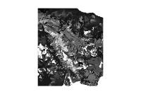
Thumbnail

Tags
vegetation, raster, trepp, campell, swiss national park, snp


Summary

Raster version of the vegetationmap of Trepp Campell

Description

Raster version of the vegetation map of Trepp Campell

Credits

GIS-SNP

Use limitations

Extent

Scale Range
Maximum (zoomed in) 1:5,000
Minimum (zoomed out) 1:150,000,000

ArcGIS Metadata 

Topics and Keywords 

*Content type  Downloadable Data


Citation 

*Title vegetation_tc


Presentation formats* digital table


Resource Details 

Dataset languages  English (SWITZERLAND)


Spatial representation type* grid


*Processing environment Microsoft Windows 7 Version 6.1 (Build 7601) Service Pack 1; Esri ArcGIS 10.1.1.3143


Credits
GIS-SNP
ArcGIS item properties
*Name vegetation_tc
*Location file://\\marmota\Data\maindata\snp\botany\gis_pub\treppcamp_veg.gdb
*Access protocol Local Area Network

Extents 

Extent in the item's coordinate system
*West longitude 802776.165765
*East longitude 816816.165765
*South latitude 166556.510348
*North latitude 176456.510348
*Extent contains the resource Yes

Geoprocessing history 

Process
Process name
Date 2009-09-02 14:45:37
Tool location C:\Programme\ArcGIS\ArcToolbox\Toolboxes\Data Management Tools.tbx\CopyRaster
Command issued
CopyRaster Q:\maindata\snp\botany\veg_trcamp\gis_pub\vegetation_tc Q:\maindata\snp\botany\treppcamp_veg.gdb\vegetation_tc # # # NONE NONE #
Include in lineage when exporting metadata No


Distribution 

Distribution format
*Name File Geodatabase Raster Dataset


Fields 

Details for object VAT_vegetation_tc 
*Type Table
*Row count 153


Field OBJECTID
 
*Alias OBJECTID
*Data type OID
*Width 4
*Precision 0
*Scale 0
*Field description
Internal feature number.
*Description source
ESRI
*Description of values Sequential unique whole numbers that are automatically generated.


Field VALUE
 
*Alias VALUE
*Data type Integer
*Width 4
*Precision 0
*Scale 0


Field COUNT
 
*Alias COUNT
*Data type Integer
*Width 4
*Precision 0
*Scale 0


Field S_VALUE
 
*Alias S_VALUE
*Data type String
*Width 20
*Precision 0
*Scale 0


Metadata Details 

Metadata language English (SWITZERLAND)
Metadata character set  utf8 - 8 bit UCS Transfer Format


Scope of the data described by the metadata  dataset
Scope name* dataset


*Last update 2013-03-13


ArcGIS metadata properties
Metadata format ArcGIS 1.0
Standard or profile used to edit metadata FGDC


Created in ArcGIS for the item 2008-12-01 13:55:25
Last modified in ArcGIS for the item 2013-03-13 95:45:30


Automatic updates
Have been performed Yes
Last update 2013-03-13 09:54:03


Thumbnail and Enclosures 

Thumbnail
Thumbnail type  JPG

Enclosure
Enclosure type  File
Description of enclosure original metadata
Original metadata document, which was translated yes
Source metadata format fgdc

FGDC Metadata (read-only) 

Identification 

Citation
Citation Information
OriginatorREQUIRED: The name of an organization or individual that developed the data set.
Publication DateREQUIRED:  he date when the data set is published or otherwise made available for release.
Title
vegetation_tc
Geospatial Data Presentation FormFgdb raster digital data
Online Linkage\\marmota\GisData\maindata\snp\botany\treppcamp_veg.gdb

Description
Abstract
Raster version of the vegetation map of Trepp Campell
Purpose
Raster version of the vegetationmap of Trepp Campell
Time Period of Content
Time Period Information
Single Date/Time
Calendar DateREQUIRED:  he year (and optionally month, or month and day) for which the data set corresponds to the ground.
Currentness Reference
REQUIRED: The basis on which the time period of content information is determined.
Status
ProgressREQUIRED: The state of the data set.
Maintenance and Update FrequencyREQUIRED: The frequency with which changes and additions are made to the data set after the initial data set is completed.

Spatial Domain
Bounding Coordinates
West Bounding CoordinateREQUIRED: Western-most coordinate of the limit of coverage expressed in longitude.
East Bounding CoordinateREQUIRED: Eastern-most coordinate of the limit of coverage expressed in longitude.
North Bounding CoordinateREQUIRED: Northern-most coordinate of the limit of coverage expressed in latitude.
South Bounding CoordinateREQUIRED: Southern-most coordinate of the limit of coverage expressed in latitude.

Keywords
Theme
Theme Keyword ThesaurusREQUIRED: Reference to a formally registered thesaurus or a similar authoritative source of theme keywords.
Theme KeywordREQUIRED: Common-use word or phrase used to describe the subject of the data set.

Access Constraints
REQUIRED: Restrictions and legal prerequisites for accessing the data set.
Use Constraints
REQUIRED: Restrictions and legal prerequisites for using the data set after access is granted.
Native Data Set Environment
Microsoft Windows XP Version 5.1 (Build 2600) Service Pack 3; ESRI ArcCatalog 9.3.1.3000

Spatial Data Organization 

Direct Spatial Reference MethodRaster


Raster Object Information
Raster Object TypePixel
Row Count495
Column Count702
Vertical Count1

Spatial Reference 

Horizontal Coordinate System Definition
Planar
Planar Coordinate Information
Planar Coordinate Encoding Methodrow and column
Coordinate Representation
Abscissa Resolution20.000000
Ordinate Resolution20.000000


Entities and Attributes 

Distribution Information 

Resource DescriptionDownloadable Data
Standard Order Process
Digital Form
Digital Transfer Information
Transfer Size2.348

Metadata Reference 

Metadata Date2009-09-02
Metadata Contact
Contact Information
Contact Organization Primary
Contact OrganizationREQUIRED: The organization responsible for the metadata information.
Contact PersonREQUIRED: The person responsible for the metadata information.
Contact Address
Address TypeREQUIRED: The mailing and/or physical address for the organization or individual.
CityREQUIRED: The city of the address.
State or ProvinceREQUIRED: The state or province of the address.
Postal CodeREQUIRED: The ZIP or other postal code of the address.

Contact Voice TelephoneREQUIRED: The telephone number by which individuals can speak to the organization or individual.

Metadata Standard NameFGDC Content Standards for Digital Geospatial Metadata
Metadata Standard VersionFGDC-STD-001-1998
Metadata Time Conventionlocal time